Gifts for Hikers and Peak Baggers
A hiker will not wear the fleece you buy them. But a map of the summit they trained for is a different kind of gift: proof, in ink, that the mountain happened.
Hikers are easier to shop for than skiers, but only slightly. The gear is personal, the boots are non-negotiable, and the freeze-dried meals are a science you should not attempt. What a hiker actually accumulates is summits, and summits are annoyingly difficult to wrap.
A topographic map of the mountain is the closest available option. Each one here is drawn from real elevation data by a pen plotter in our Vermont studio, one contour line at a time, so the terrain on the wall is the terrain from the trail: the switchbacks are in the tight lines, the false summits are all present and accounted for. For someone who has stood on the top, it reads less like art and more like evidence.
The rule is the same as for any gift of geography: pick the mountain that means something. The one they finished, the one they’re training for, the one they will not stop mentioning. All 136 of them are in the peaks collection; a few proven choices follow.
For the Northeast hiker
Mount Washington is the crown of New Hampshire hiking and a mountain best summarized by the fact that its summit observatory is chained to the rock. In 1934 the station measured a 231 mile per hour wind gust, a world record that stood for sixty-two years, on a peak that stands just 6,288 feet tall. Anyone who has climbed it in any month, in any weather, has an opinion about it. The map gives that opinion somewhere to hang.
Katahdin is the northern terminus of the Appalachian Trail, which means the people most attached to it earned that attachment over more than 2,000 miles of walking from Georgia. The name is Penobscot for greatest mountain, and the map shows why it sticks: the massif stands alone above the Maine lake country, with the Knife Edge printing as a razor-thin band of compressed lines between Baxter and Pamola peaks. For someone who walked all that way to stand on it, this is the one map that counts.
Mount Mansfield is Vermont’s highest point and its summit is called the Chin, one feature of a ridgeline that early settlers decided was a face staring at the sky. The ridge runs above treeline for over a mile, which for New England is practically arctic, because botanically speaking it is.
For the western trip they still talk about
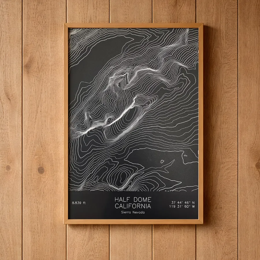
Half Dome was declared perfectly inaccessible by a state survey in 1865 and was climbed ten years later, a timeline that says something about surveys, or about climbers. Its sheared northwest face rises some 4,800 feet above the Yosemite Valley floor, and hikers still reach the top by the cable route up its rounded shoulder. For anyone who has clutched those cables, the map’s nearly solid band of contour lines on the northwest side will produce a small, involuntary hand cramp.
Mount Rainier has worms living inside its glaciers, surfacing at dawn to graze on algae in the snow, and it is visible from 300 miles away on the days it chooses to be visible at all. Twenty-five named glaciers radiate from the summit, and the map’s contours radiate with them. It is the mountain for the hiker who circled it on the Wonderland Trail, climbed it, or simply spent years in Seattle checking whether it was out.
For the armchair mountaineer
Mount Everest requires no trip report. The summit is marine limestone, former seafloor carried five and a half miles into the sky by the collision of two continents, and the map shows the three great ridges meeting at the highest point there is. This is the gift for the person whose shelf holds every mountaineering disaster book ever written and who has no intention, they are quick to clarify, of going.
Practical matters
Every map is an original pen plot on archival cotton paper, signed and dated, available in multiple colorways and three sizes up to 18x24. The elevation data is real, which matters more for this audience than any other: hikers check. Start with the peaks collection, or browse the national parks if their loyalty is to a place rather than a summit.