About
Maps that tell
the story of a place
Flow Line Maps makes minimalist topographic art: maps that distill the essential character of mountains, trails, and landscapes into clean, precise line work.
Every piece starts as raw geographic data and ends as a pen-plotted original. The work sits at the intersection of cartography, code, and mechanical drawing. Algorithms design the map; a pen plotter draws it, line by line, in real ink.
The result pairs the precision of code with the tactile texture and imperfections of real pen and paper. Art that rewards a closer look, where you can trace the ridgeline of a peak you've summited or follow the switchbacks of a trail you've ridden.
The process
From data to drawn
01 /
Gather the data
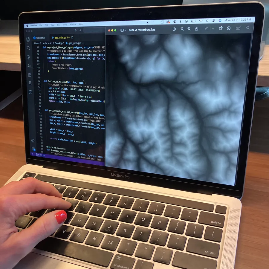
Every map begins with raw geographic data: high-resolution elevation models, precise geospatial coordinates, and carefully curated route data. The quality of the data is what transforms a map into art.
02 /
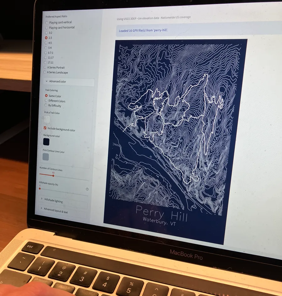
Generate the design
Custom software transforms elevation data into layered contour artwork. Spacing, contour density, and bounding boxes are tuned for each location to capture the terrain's character. A gentle rolling peak gets different treatment than a jagged alpine face.
03 /
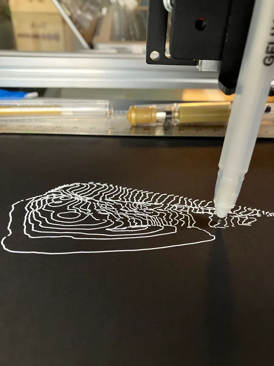
Plot with precision
A pen plotter translates each digital design into analog form, drawing every line on archival paper. Each plot is an exercise in controlling the flow of ink onto paper, merging mechanical precision with the organic texture of real media. Plot times range from 30 minutes to 5 hours depending on complexity.
04 /
Inspect & ship
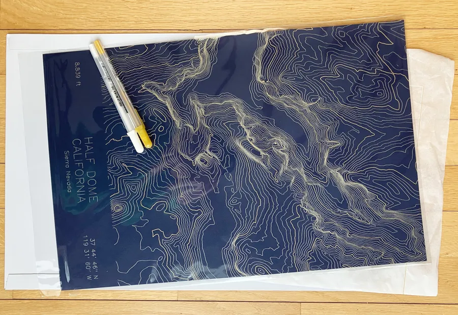
Every piece is inspected and signed, carefully packaged, and shipped flat. Ready to frame, or ready to gift.
+ Materials & quality
Data
Each map begins with high-resolution elevation data: LiDAR, DEMs, and terrain models. Finding and refining the right data is part of the craft; the quality of the source shapes the final artwork.
Paper
Museum-grade, acid-free cotton paper chosen for detail and longevity. The subtle tooth of the paper catches each plotted line, giving the artwork depth while preserving the crispness of the drawing.
Ink
Archival pigment inks selected for lasting color and refined balance. Each color is tuned to feel vibrant yet understated, at home in both modern and natural spaces.
Plotting
Each map is drawn by a pen plotter, a precision machine that moves a real pen across the paper line by line. Plot times range from 30 minutes to several hours depending on complexity.
+ Giving back
We make every map in Vermont, near the same mountains we hike, ski, and ride. Every contour line comes from real terrain. Terrain that needs people maintaining trails, protecting access, and keeping wild places wild. $2 from every map goes to organizations doing that work.