Maine
Acadia National Park
45 miles of carriage roads, built so John D. Rockefeller Jr. would never have to meet a car.
$54
Original pen plot · signed · no two identical
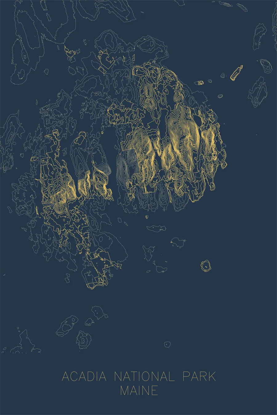
Ink & paper: Blue
Made to order. Ships flat in 1–4 business days. Shipping & returns
+ Details
- 12 × 18 inches
- Drawn on 98 lb (160 gsm) archival cotton paper
- Precision technical pens and archival inks
- Signed and dated on the back
- Ships flat, protected, ready to frame
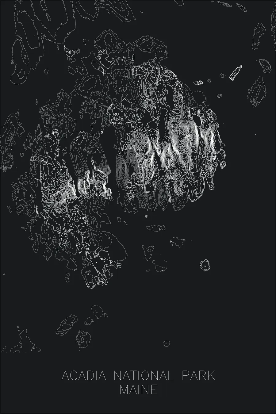
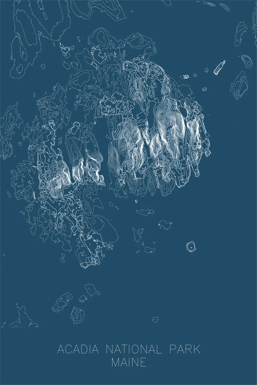
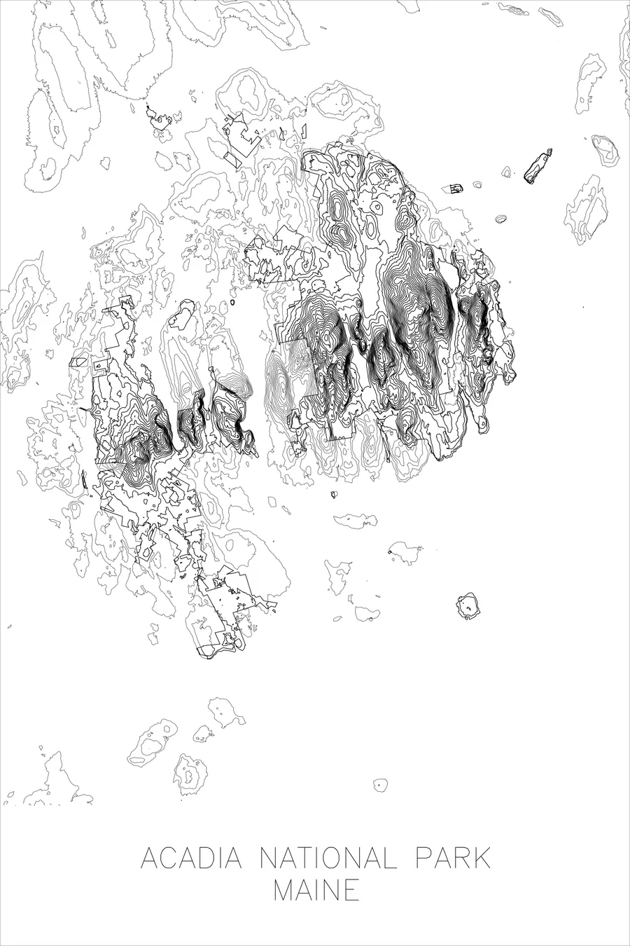
Each map begins with elevation data and is drawn by a pen plotter in our Vermont studio. Mechanical precision, plus the texture and small imperfections of real ink on paper.
+ About this map
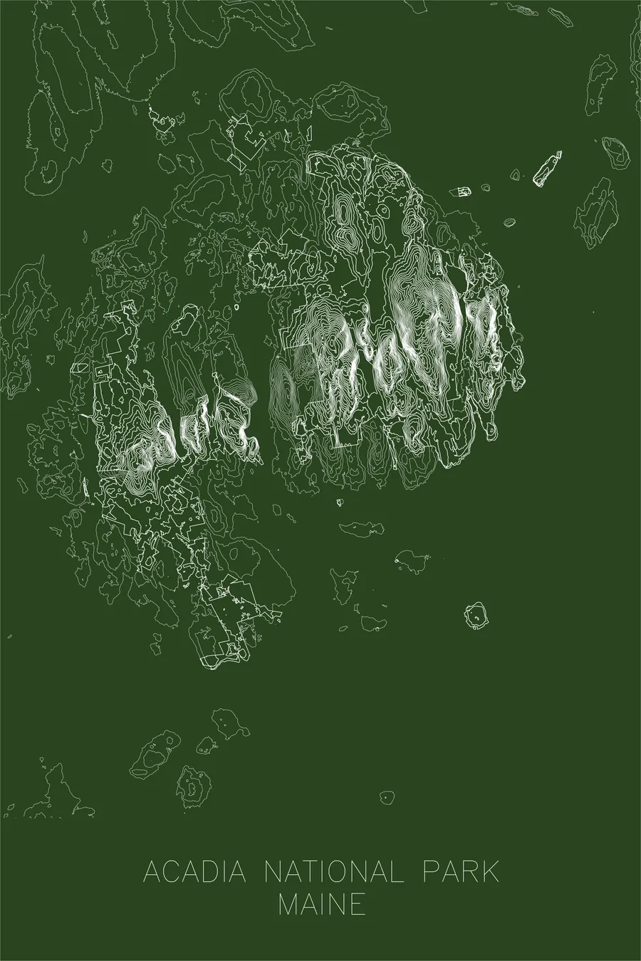
John D. Rockefeller Jr. wanted to keep traveling by horse and carriage without meeting a motor vehicle, and his solution was to build 57 miles of road where cars would never be allowed. Mount Desert Island had banned the automobile in 1903; when Bar Harbor relented and cars returned in 1913, Rockefeller responded by personally financing and overseeing a network of car-free carriage roads, along with 16 of the island’s 17 stone-faced bridges, a project that occupied him until 1940. Forty-five of those miles now run through Acadia National Park, where Cadillac Mountain, 1,530 feet, is the first place in the United States to catch the sunrise from early October to early March.
This map captures the distinctive terrain of an island shaped by glaciation, where rounded granite peaks rise abruptly from the sea. The contour lines trace the deep U-shaped valleys carved by ice, the narrow ridgelines that connect summit to summit, and the fjord-like intrusion of Somes Sound, the glacially carved arm of the sea that nearly splits the island in two. The result is a portrait of compression, an extraordinary amount of topographic drama packed into a small island at the edge of a continent.
+ Site data
- Location
- Acadia National Park
- Range
- Appalachian
- Region
- New England
- Elevation
- 1,530 ft / 466 m
- Coordinates
- 44.3386N 68.2733W
- Type
- national park
- Notes
- The first national park east of the Mississippi, where mountains meet the Atlantic
Off the screen
In real rooms


Real plots in the selected colorway
More maps