Alaska
Denali
The 1910 Sourdough party carried doughnuts and a 14-foot spruce pole to the top of the wrong summit.
$54
Original pen plot · signed · no two identical
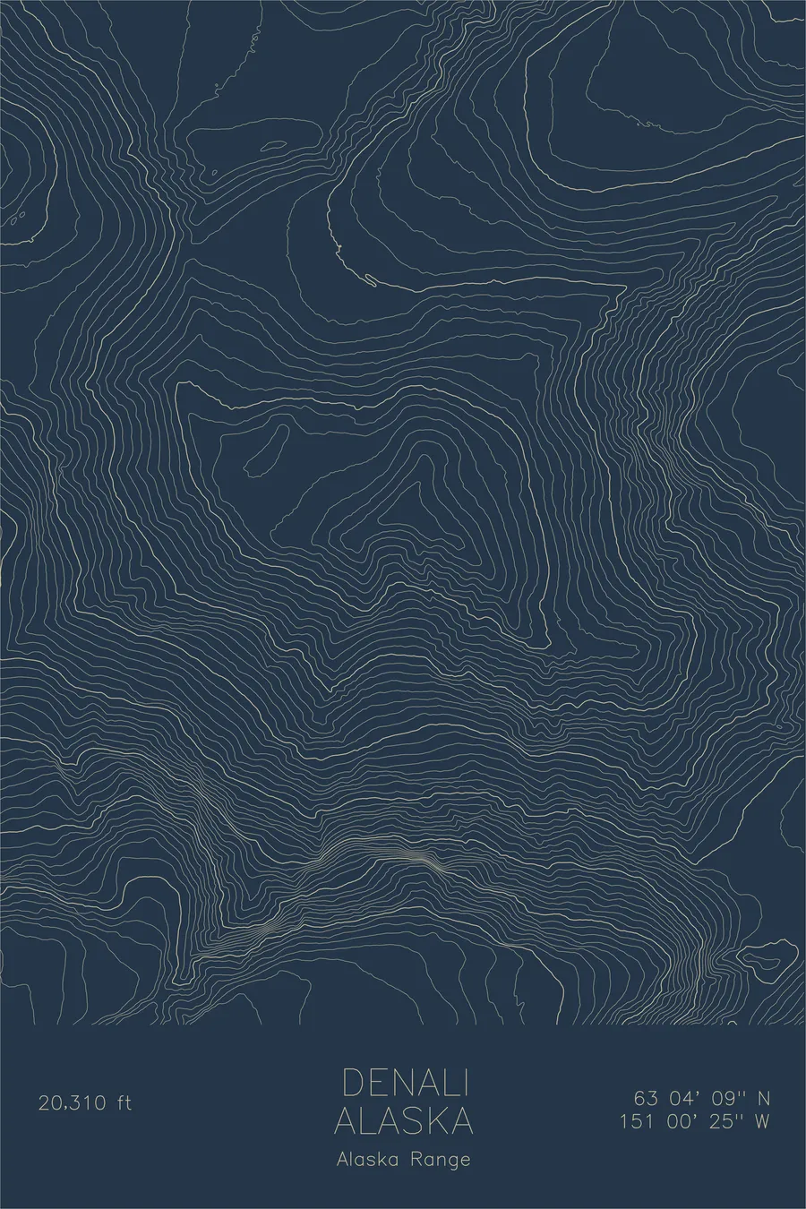
Ink & paper: Navy
Size: 12×18"
Made to order. Ships flat in 1–4 business days. Shipping & returns
+ Details
- 12 × 18 inches
- Drawn on 98 lb (160 gsm) archival cotton paper
- Precision technical pens and archival inks
- Signed and dated on the back
- Ships flat, protected, ready to frame
Each map begins with elevation data and is drawn by a pen plotter in our Vermont studio. Mechanical precision, plus the texture and small imperfections of real ink on paper.
+ About this map
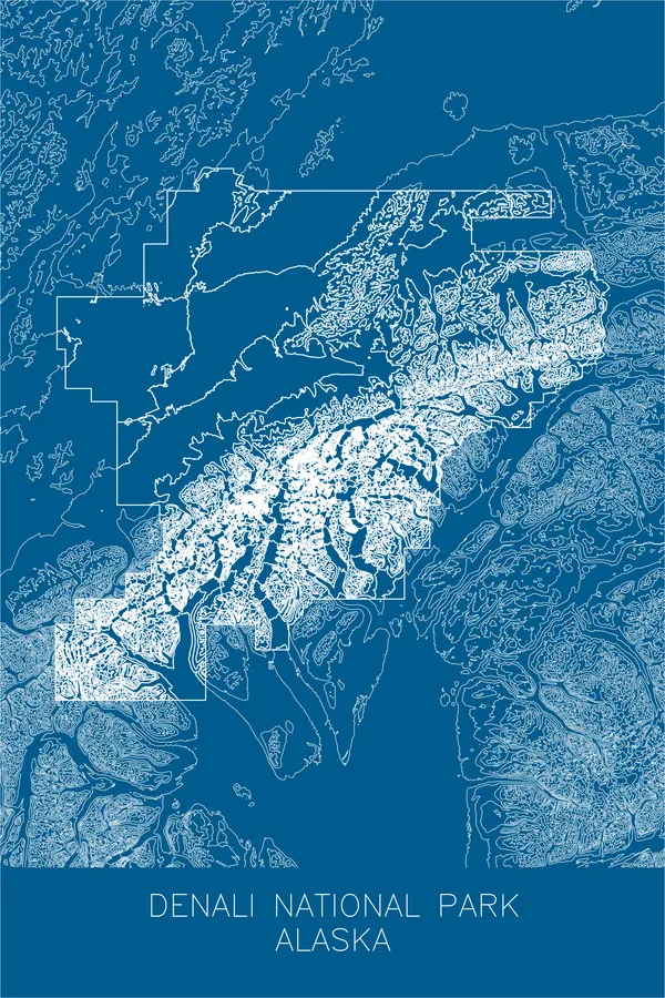
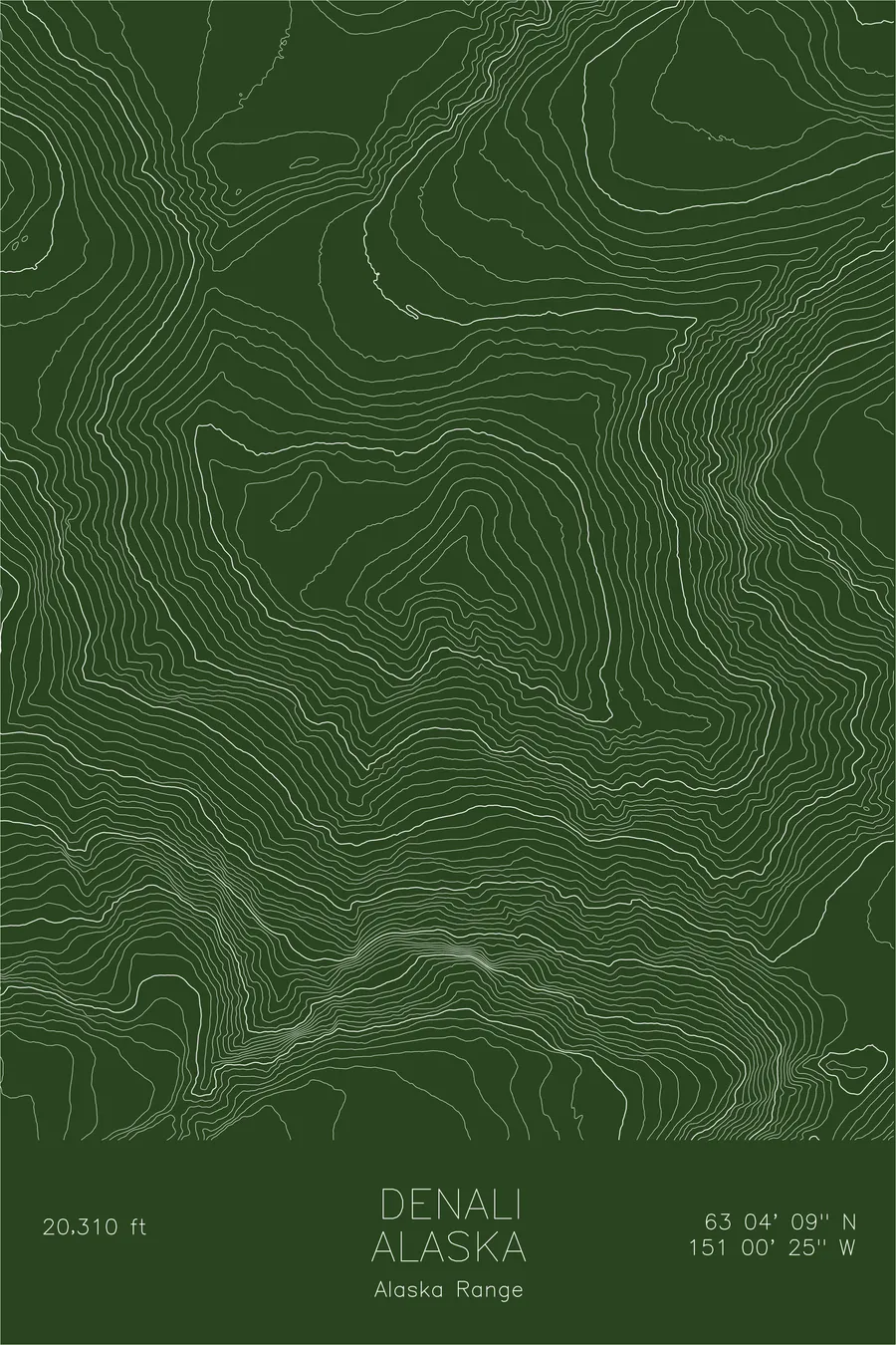
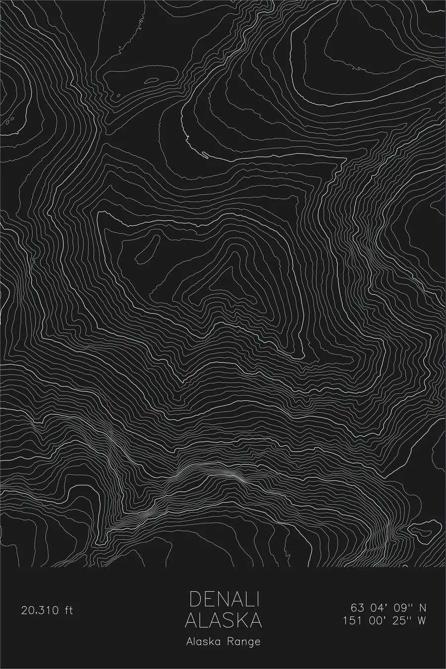
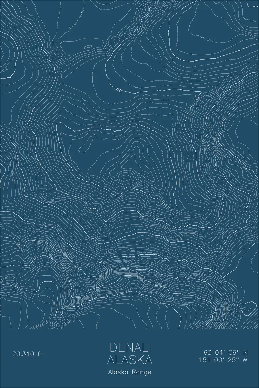
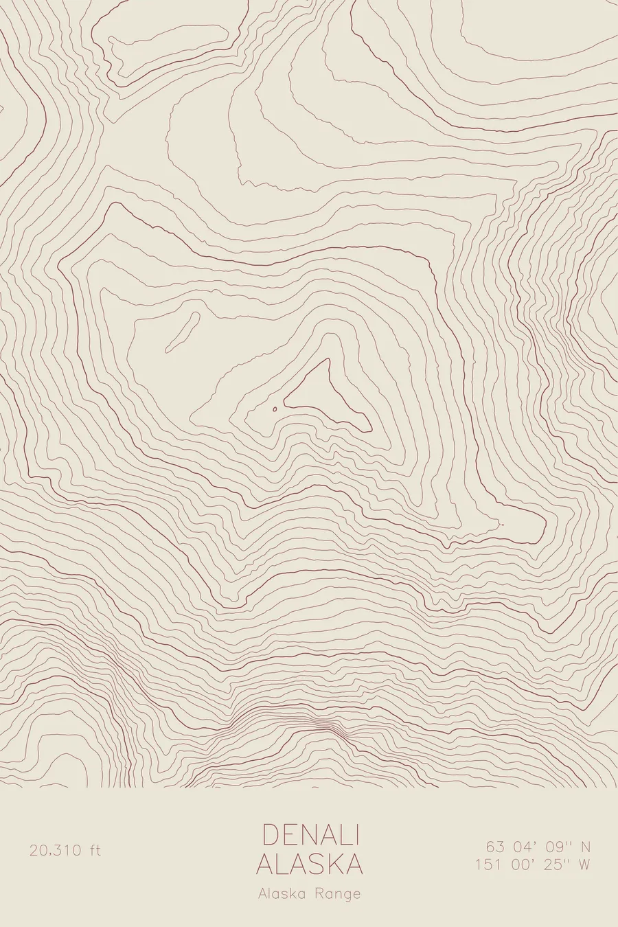
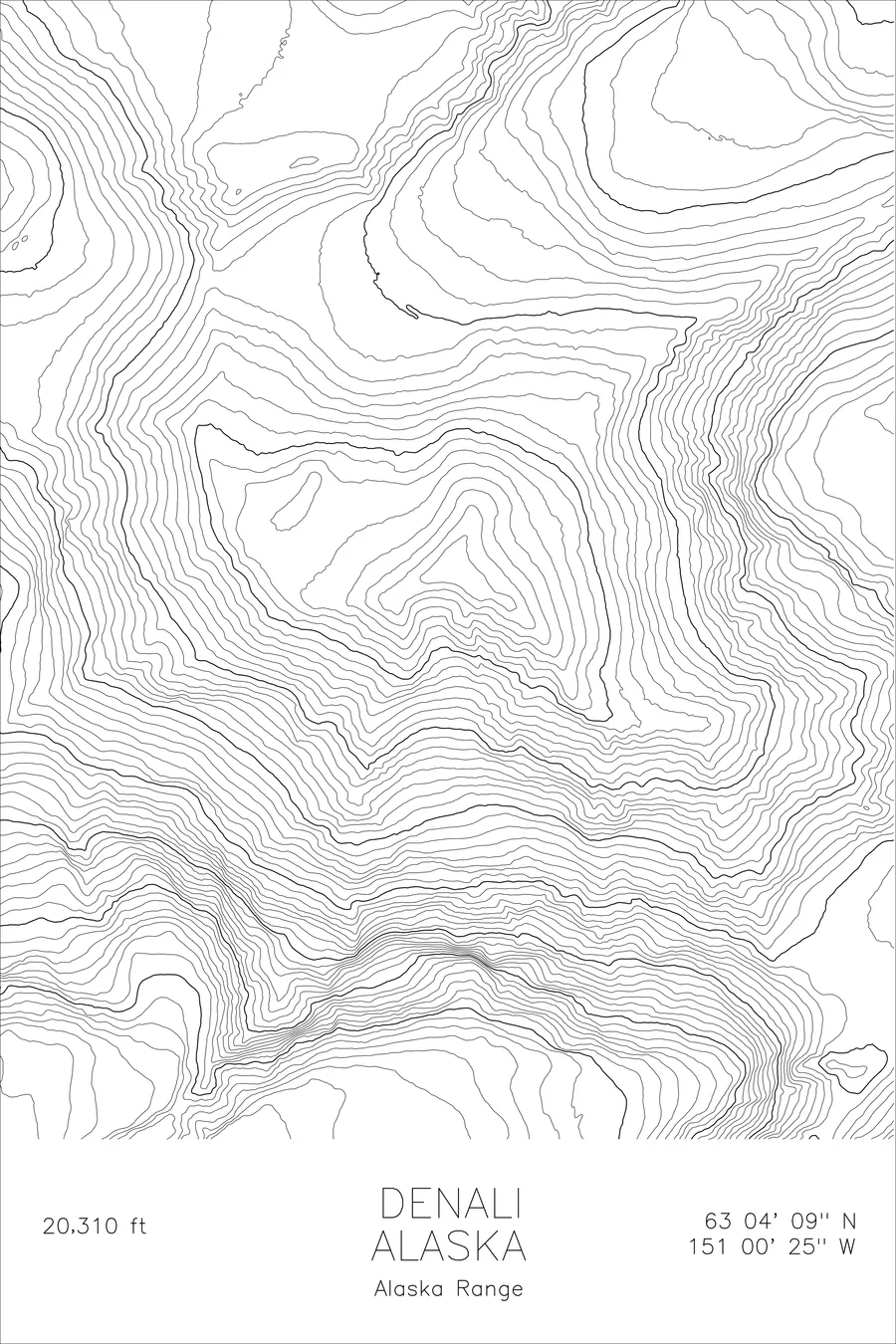
On April 3, 1910, gold miners of the Sourdough expedition climbed Denali’s final 8,000 feet and back in about 18 hours, carrying a bag of doughnuts, three thermoses of hot chocolate, some caribou meat, and a 14-foot spruce pole, which Billy Taylor and Pete Anderson planted on top hoping it could be seen from Fairbanks, 150 miles away. It was also the wrong summit: the North Peak, 19,470 feet, lower than the true one, and the pole went unconfirmed until Hudson Stuck’s 1913 first-ascent party spotted it from the real top, which stands at 20,310 feet and, measured base to summit, rises farther than any other mountain on land.
This map captures the full topographic sweep of Denali and its satellite peaks. The contour lines trace massive glacial systems: the Kahiltna, Ruth, and Muldrow glaciers that flow for miles from the upper slopes. The density of the lines near the summit reveals the extraordinary steepness that makes this one of the most challenging climbs on any continent.
+ Site data
- Location
- Denali
- Range
- Alaska Range
- Region
- Alaska
- Elevation
- 20,310 ft / 6,190 m
- Coordinates
- 63.0695N 151.0074W
- Type
- peak
- Notes
- Highest peak in North America: greatest base-to-summit rise of any mountain on land
Off the screen
In real rooms


Real plots in the selected colorway
More maps