Texas
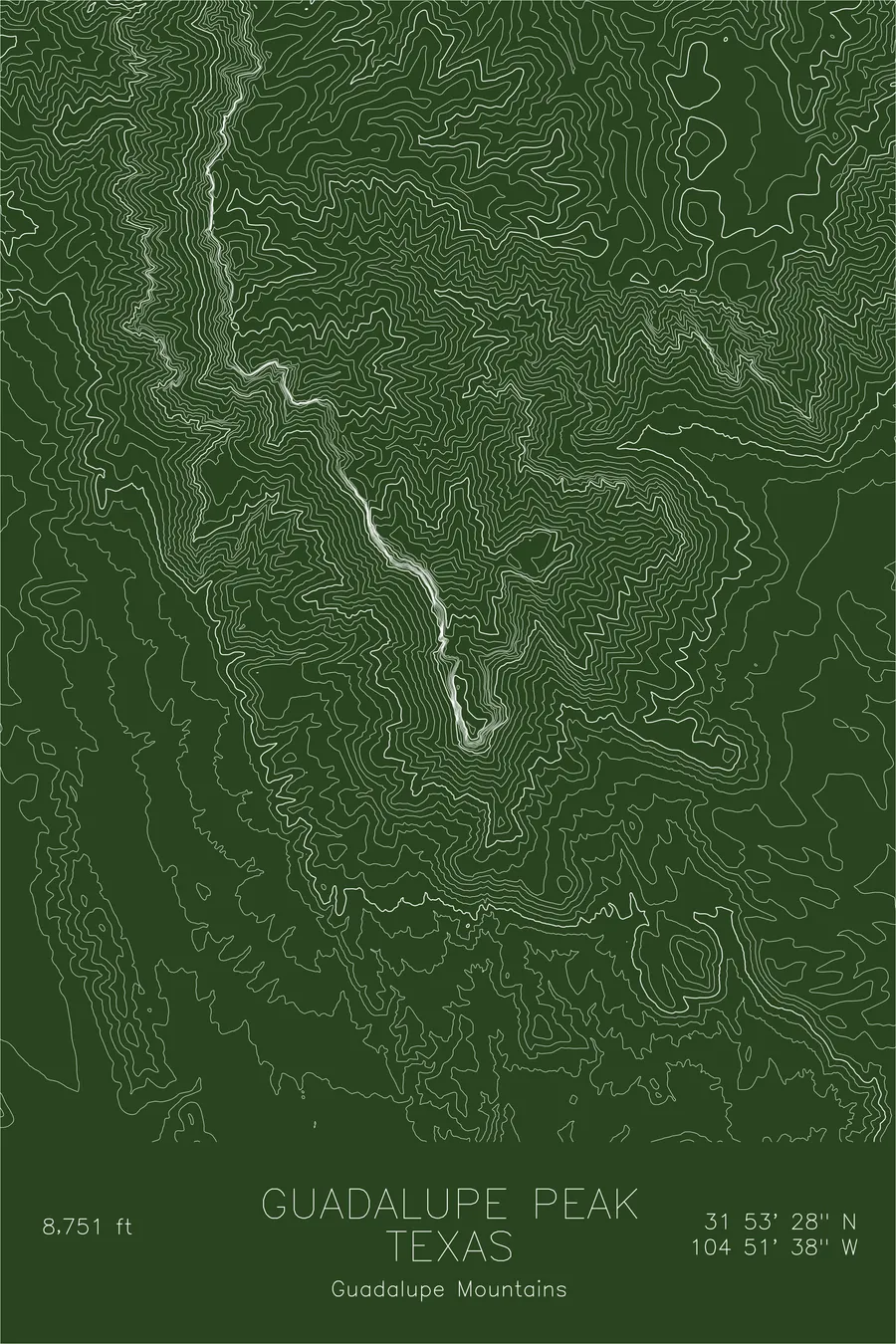
Guadalupe Peak
The summit marker is a stainless steel pyramid installed by American Airlines in 1958.
$54
Original pen plot · signed · no two identical
Ink & paper: Green
Size: 12×18"
Made to order. Ships flat in 1–4 business days. Shipping & returns
+ Details
- 12 × 18 inches
- Drawn on 98 lb (160 gsm) archival cotton paper
- Precision technical pens and archival inks
- Signed and dated on the back
- Ships flat, protected, ready to frame
Each map begins with elevation data and is drawn by a pen plotter in our Vermont studio. Mechanical precision, plus the texture and small imperfections of real ink on paper.
+ About this map
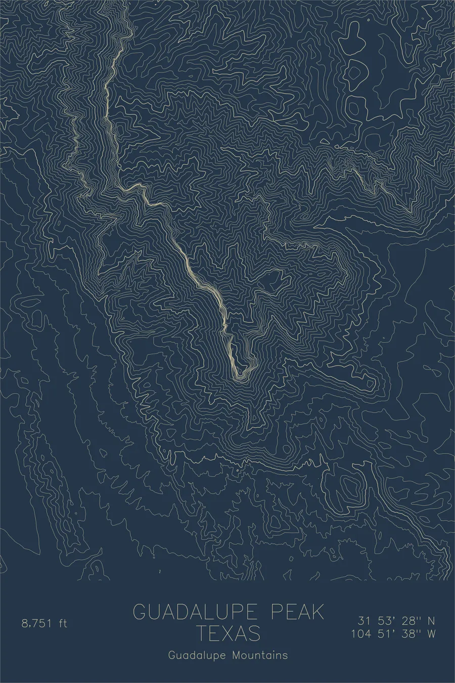
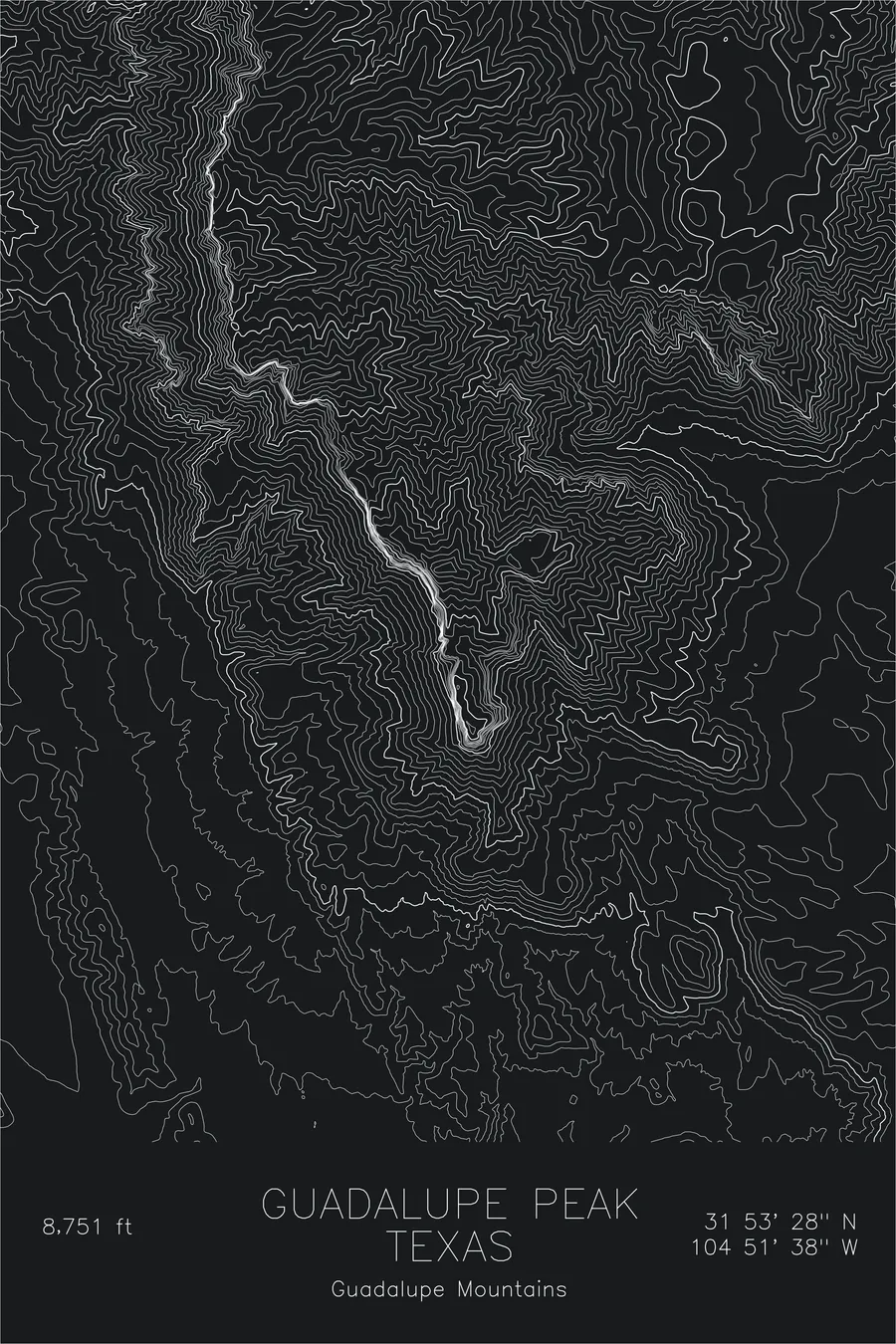
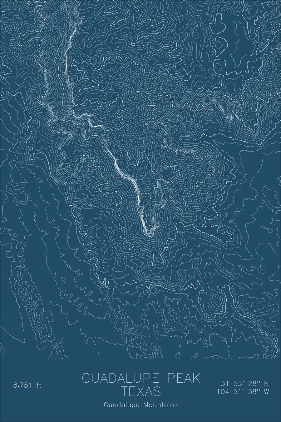
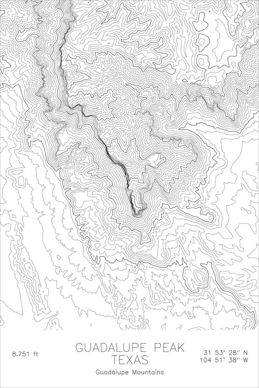
The highest point in Texas is topped by a six-foot stainless steel pyramid erected by American Airlines, a company not otherwise known for its mountaineering. The pyramid went up in 1958 to mark the 100th anniversary of the Butterfield Overland Mail stage route, which passed south of the mountain, and its three faces carry the airline’s logo, a U.S. Postal Service tribute to the stage riders, and a Boy Scouts of America compass. The mountain underneath is 8,751 feet of Permian limestone, the exposed spine of the Capitan Reef, which formed at the edge of a shallow tropical sea roughly 260 million years ago.
This map traces the dramatic topography of the peak and its surroundings. The contour lines compress sharply along the western escarpment, where the mountain drops over 3,000 feet to the salt flats below. The gentler eastern slopes and the deep cuts of McKittrick Canyon reveal the layered geology that makes this one of the most geologically significant summits in North America.
+ Site data
- Location
- Guadalupe Peak
- Range
- Guadalupe Mountains
- Region
- Southwest
- Elevation
- 8,751 ft / 2,667 m
- Coordinates
- 31.8912N 104.8605W
- Type
- peak
- Notes
- Highest point in Texas, the ancient reef summit of an inland sea
Off the screen
In real rooms


Real plots in the selected colorway
More maps