Colorado
Mount Sneffels
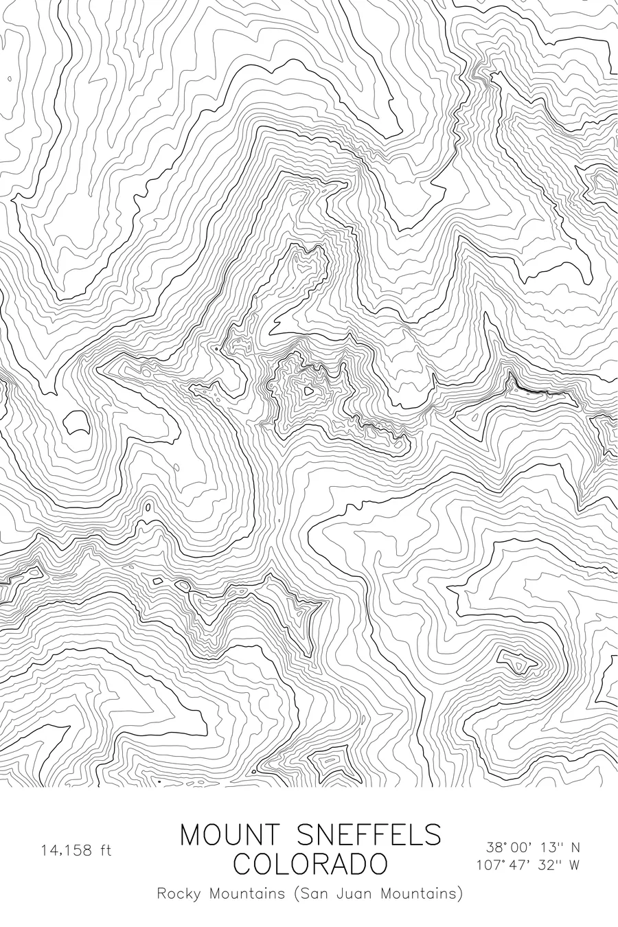
One of the most photographed fourteeners in Colorado, named after the volcano in Jules Verne's Journey to the Center of the Earth. 14,158 feet above sea level.
$54
Original pen plot · signed · no two identical
Ink & paper: Green
Size: 12×18"
Made to order. Ships flat in 1–4 business days. Shipping & returns
+ Details
- 12 × 18 inches
- Drawn on 98 lb (160 gsm) archival cotton paper
- Precision technical pens and archival inks
- Signed and dated on the back
- Ships flat, protected, ready to frame
Each map begins with elevation data and is drawn by a pen plotter in our Vermont studio. Mechanical precision, plus the texture and small imperfections of real ink on paper.
+ About this map
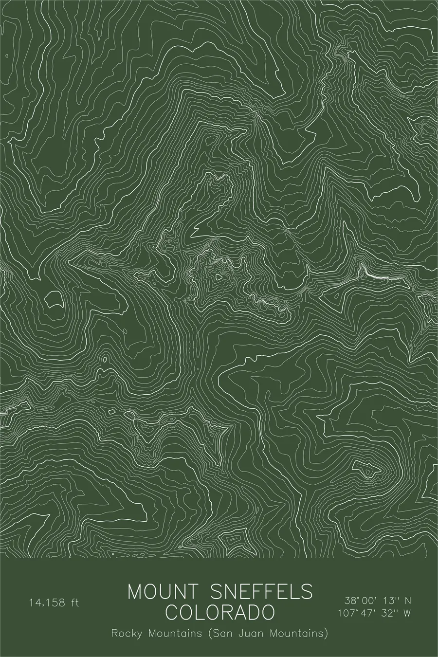
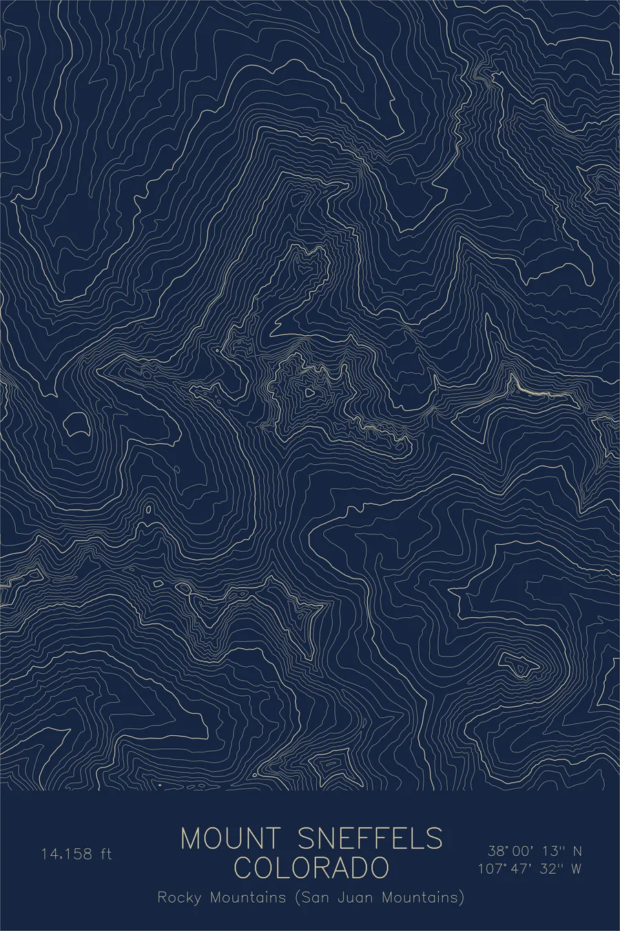
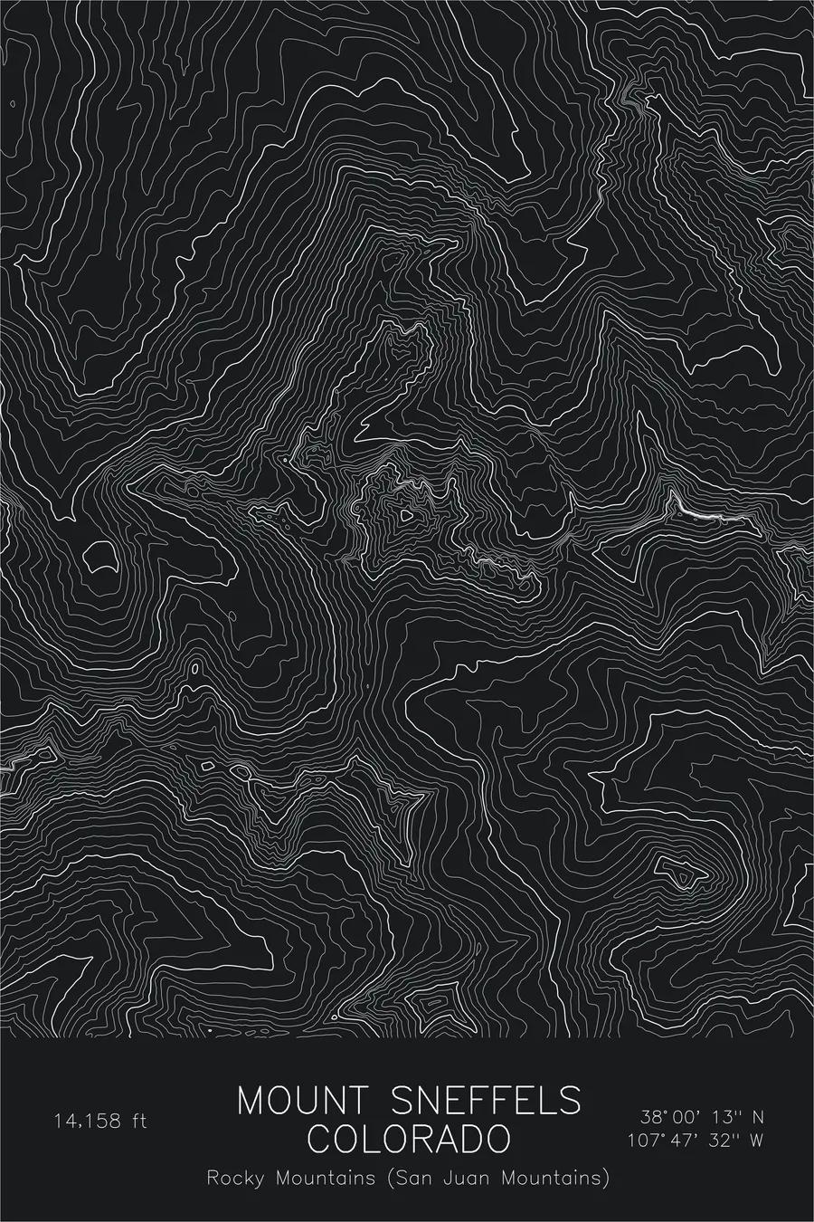
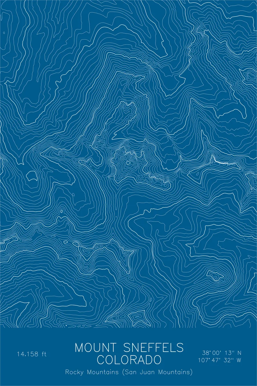
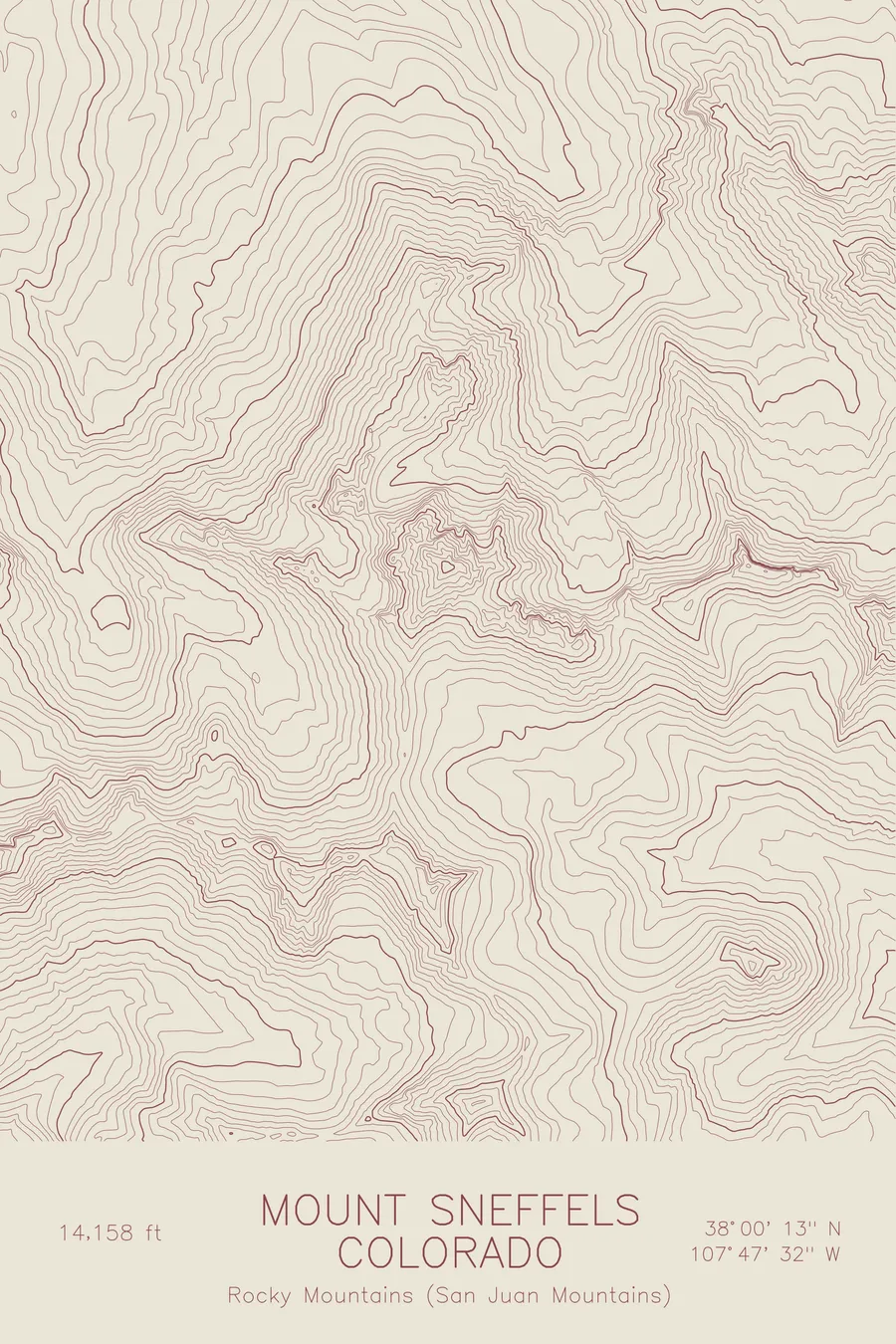
Mount Sneffels rises to 14,158 feet in the San Juan Mountains of southwestern Colorado, the highest peak in the Sneffels Range and one of the most visually striking fourteeners in the state. Named after the Icelandic volcano in Jules Verne’s Journey to the Center of the Earth, it is the eroded remnant of a Tertiary-era volcanic caldera, its summit a jagged spire of dark volcanic rock that stands sharply above the surrounding ridges.
This map captures the rugged terrain of the Sneffels massif. The contour lines tighten dramatically near the summit, where the peak narrows to a rocky point above steep couloirs and cirque walls. Yankee Boy Basin opens to the south as a broad amphitheater, its gentler contours contrasting with the cliff bands and talus fields above. The ridgelines radiate outward in sharp, angular patterns: a topographic signature of erosion cutting into ancient volcanic rock.
+ Site data
- Location
- Mount Sneffels
- Range
- San Juan Mountains
- Region
- Rocky Mountains
- Elevation
- 14,158 ft / 4,315 m
- Coordinates
- 38.0038N 107.7923W
- Type
- peak
- Notes
- One of the most photographed fourteeners in Colorado, named after the volcano in Jules Verne's Journey to the Center of the Earth
Off the screen
In real rooms


Real plots in the selected colorway
More maps