Wyoming
Grand Teton
First ascent officially settled by a 1929 resolution of the Wyoming Legislature.
$54
Original pen plot · signed · no two identical
Ink & paper: Blue
Size: 12×18"
Made to order. Ships flat in 1–4 business days. Shipping & returns
+ Details
- 12 × 18 inches
- Drawn on 98 lb (160 gsm) archival cotton paper
- Precision technical pens and archival inks
- Signed and dated on the back
- Ships flat, protected, ready to frame
Each map begins with elevation data and is drawn by a pen plotter in our Vermont studio. Mechanical precision, plus the texture and small imperfections of real ink on paper.
+ About this map
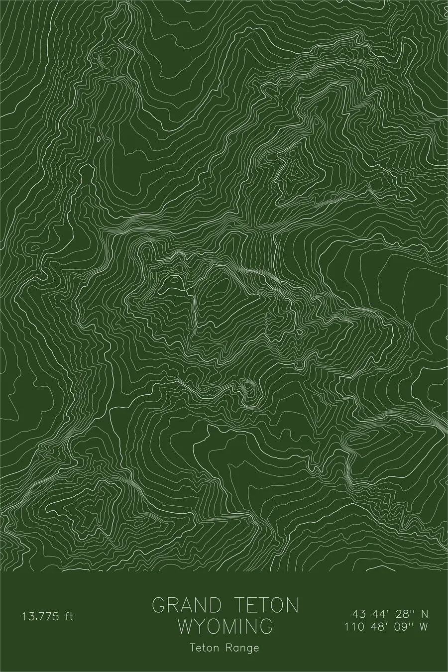
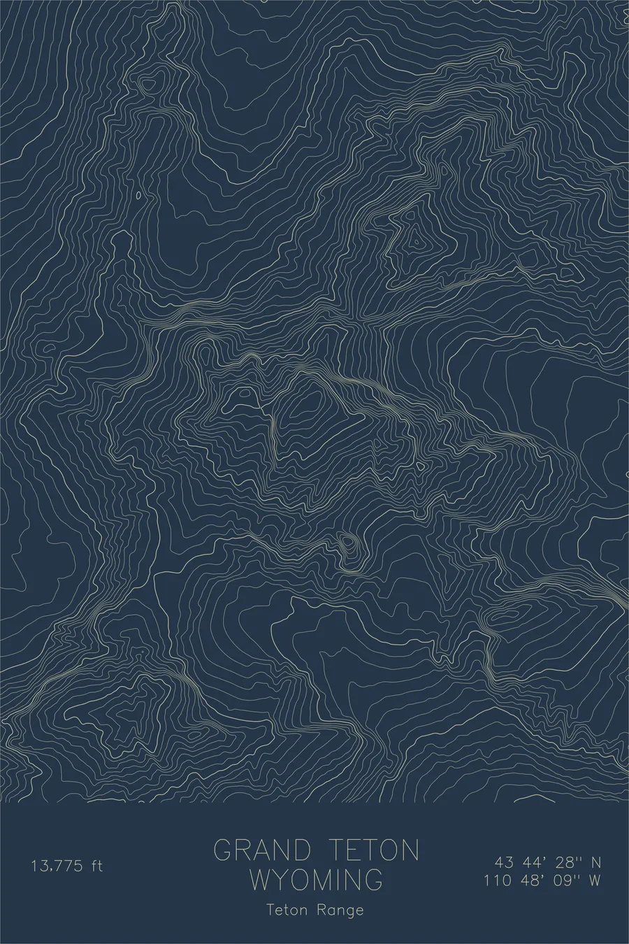
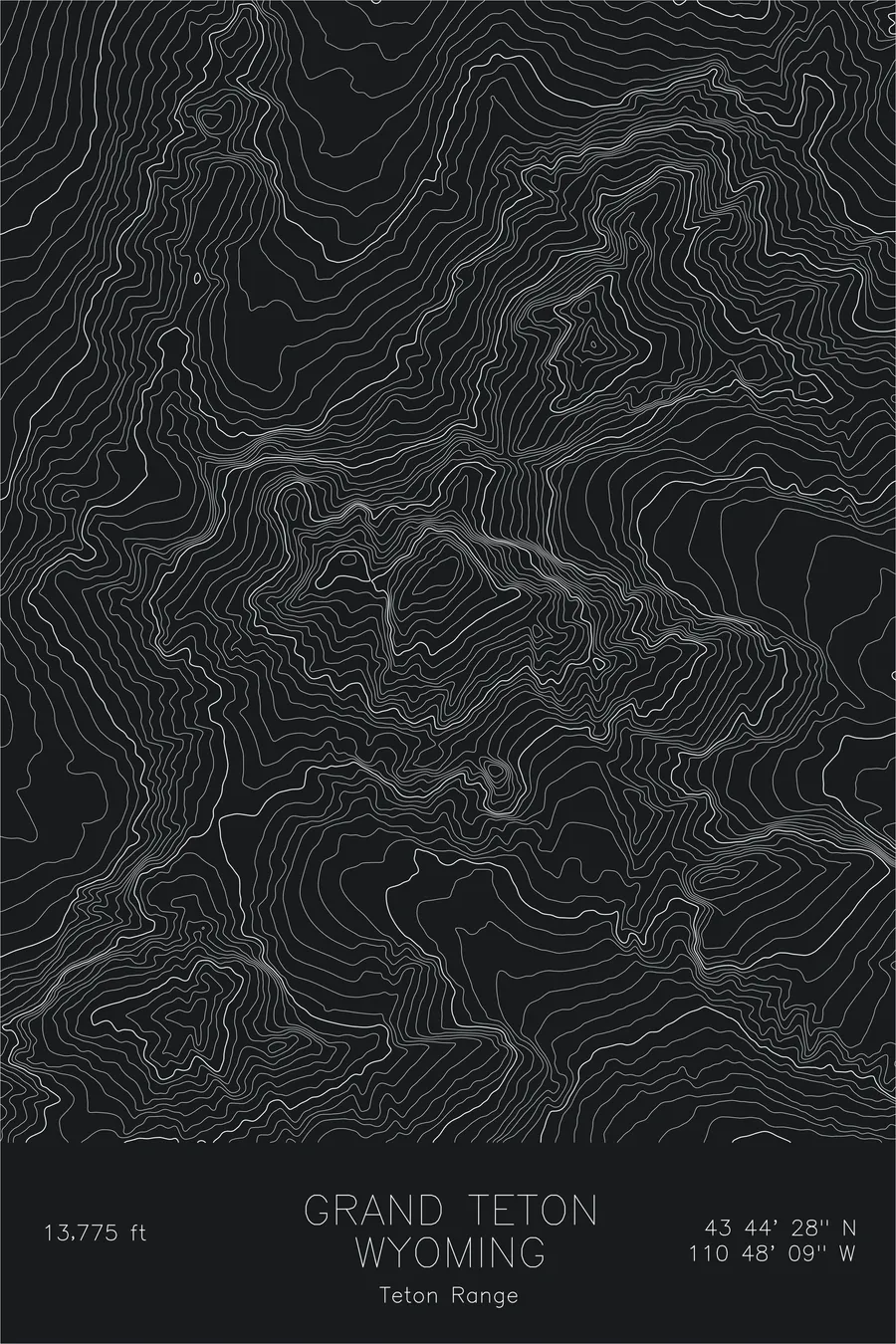
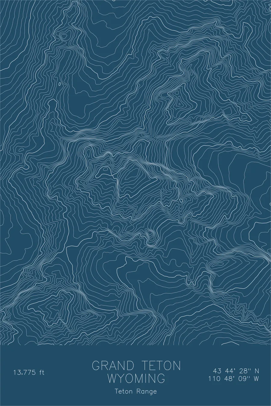
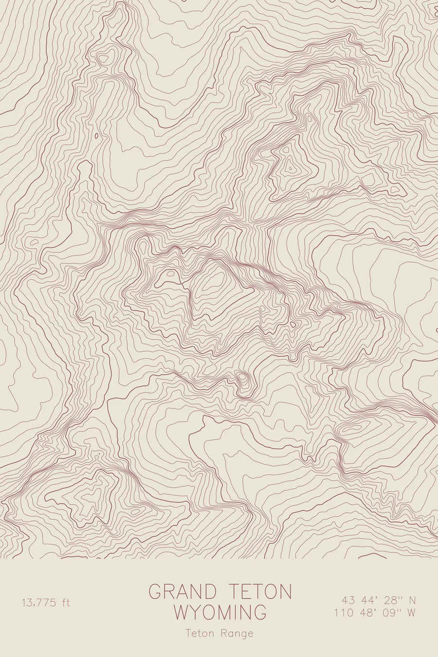
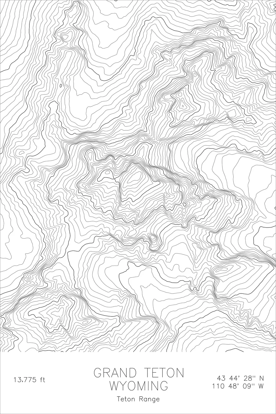
The first ascent of the Grand Teton was settled by an act of the Wyoming Legislature. William O. Owen spent roughly 30 years lobbying to have his party’s climb of August 11, 1898 recognized over Nathaniel Langford and James Stevenson’s claimed ascent of July 29, 1872, and in 1929 the legislature obliged with an official resolution crediting Owen, Rev. Franklin Spalding, John Shive, and Frank Peterson. There was one complication: Spalding, who had actually led Owen’s climb, believed the Langford claim. The mountain itself rises 13,775 feet, with a 7,000-foot vertical gain from the floor of Jackson Hole and no foothills to soften the approach.
This map captures the extreme relief that makes the range front unlike anywhere else in the Rockies. On the east face the contour lines compress into dense, nearly continuous bands where the mountain plunges toward Jackson Hole, then open into the gentler alpine terrain that descends west toward Idaho. Garnet Canyon and Cascade Canyon cut deep glacial troughs south and north of the summit, and the Teton Glacier sits in the shadowed cirque beneath the north face. Around the Grand, the tightly stacked contours of Mount Owen, Teewinot, and the Middle Teton mark the knot of high peaks climbers call the Cathedral Group.
+ Site data
- Location
- Grand Teton
- Range
- Teton Range
- Region
- Rocky Mountains
- Elevation
- 13,775 ft / 4,199 m
- Coordinates
- 43.7412N 110.8024W
- Type
- peak
- Notes
- The most dramatic fault-block mountain front in North America
Off the screen
In real rooms


Real plots in the selected colorway
More maps