Colorado
Longs Peak
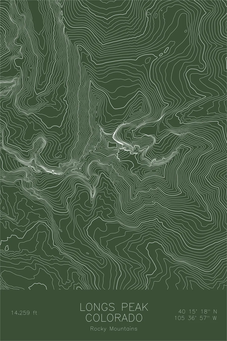
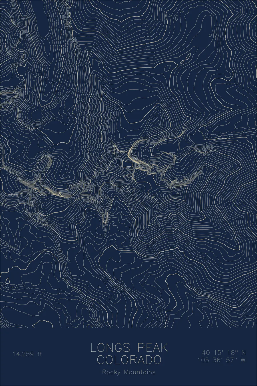
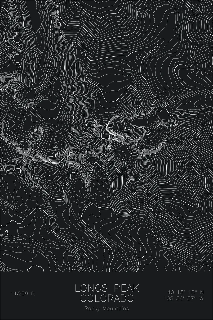
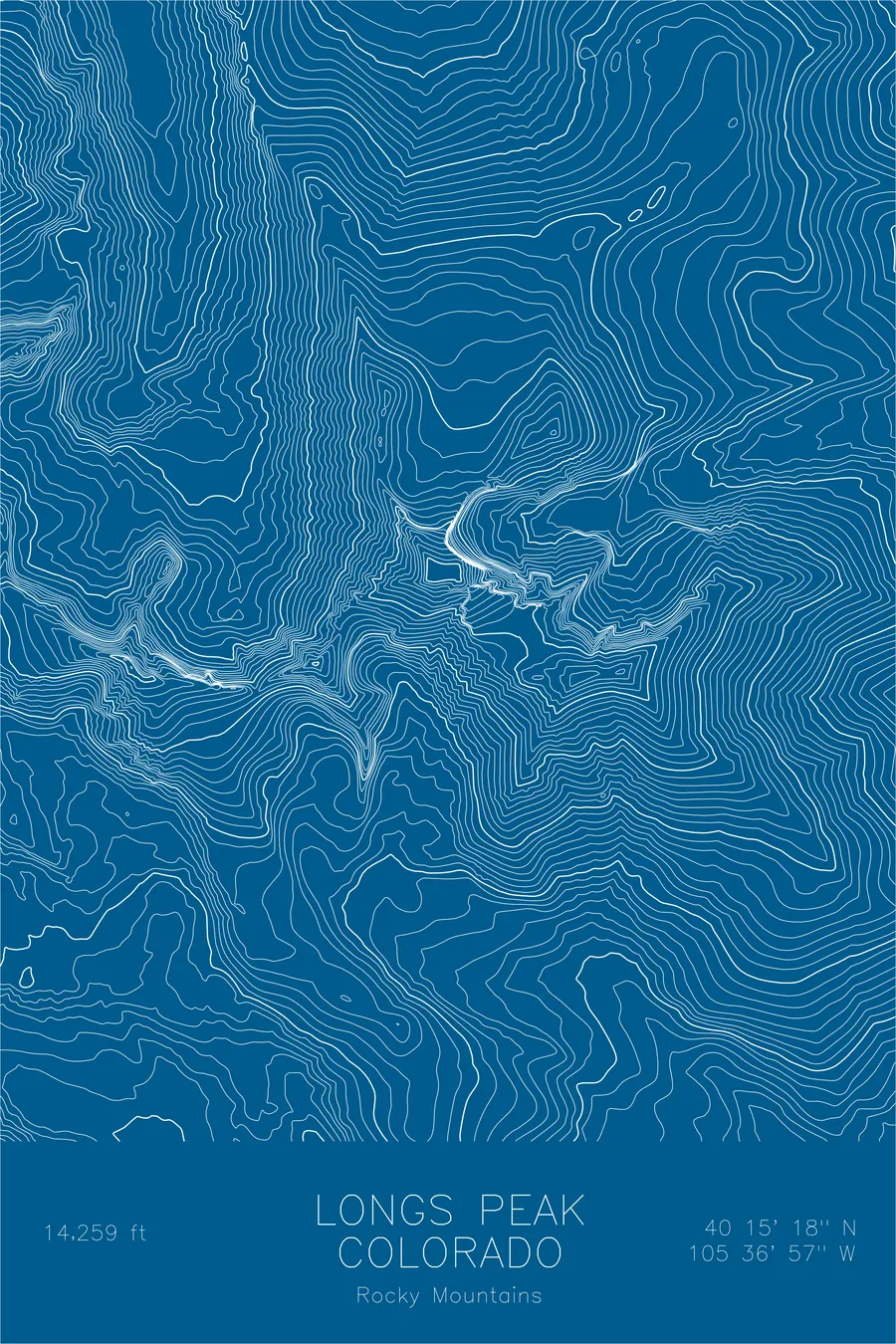
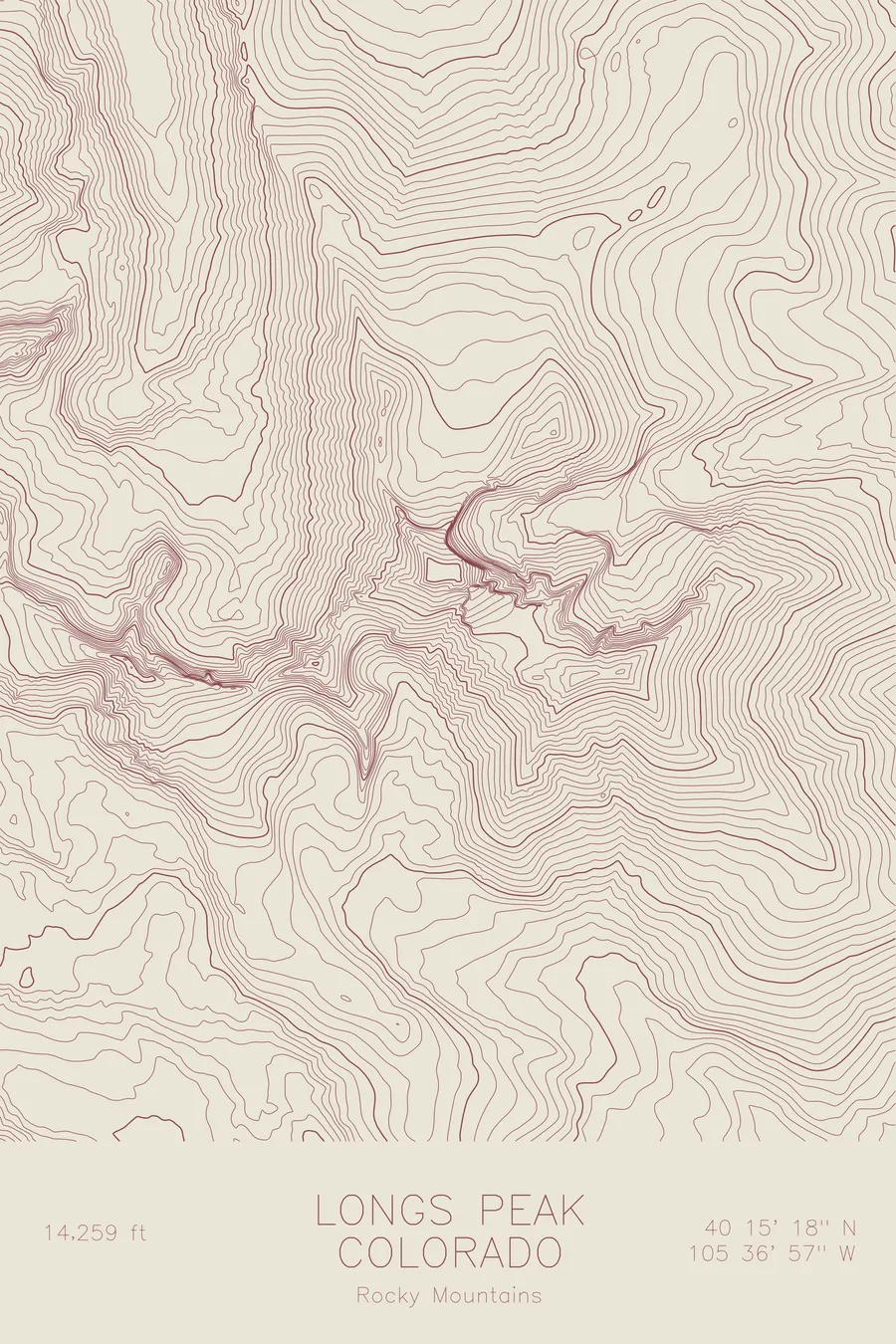
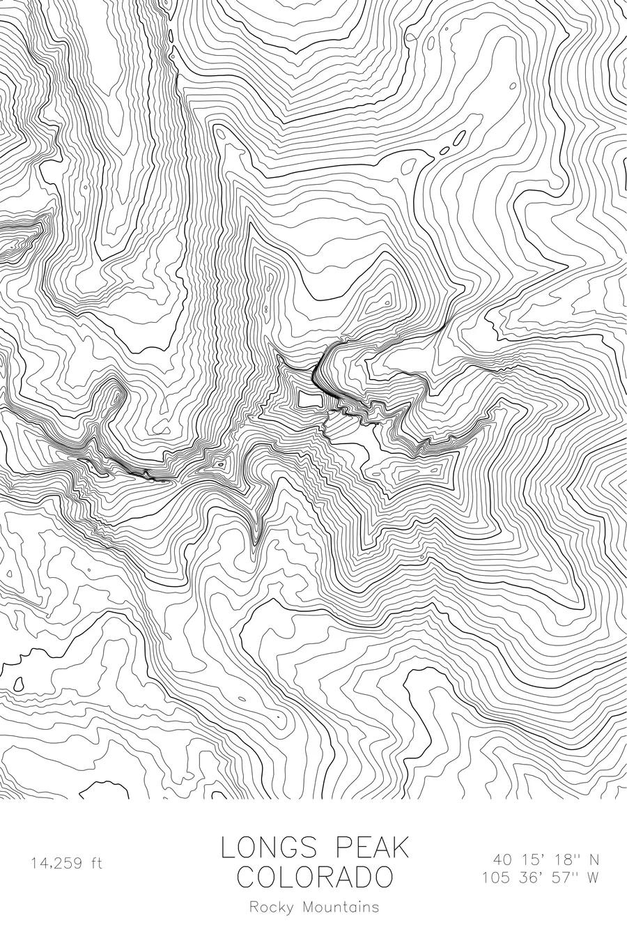
The northernmost fourteener in Colorado, crowned by the sheer Diamond face. 14,259 feet above sea level.
$54
Original pen plot · signed · no two identical
Ink & paper: Green
Size: 12×18"
Made to order. Ships flat in 1–4 business days. Shipping & returns
+ Details
- 12 × 18 inches
- Drawn on 98 lb (160 gsm) archival cotton paper
- Precision technical pens and archival inks
- Signed and dated on the back
- Ships flat, protected, ready to frame
Each map begins with elevation data and is drawn by a pen plotter in our Vermont studio. Mechanical precision, plus the texture and small imperfections of real ink on paper.
+ About this map
Longs Peak rises to 14,259 feet in Rocky Mountain National Park, the northernmost fourteener in Colorado and one of the most prominent peaks on the Front Range. Its east face, known as The Diamond, drops 900 feet of sheer granite, one of the most iconic alpine walls in North America. The flat summit plateau sits above this wall like a tabletop, a distinctive shape visible from the plains over seventy miles away.
This map traces the topographic complexity that makes Longs a peak apart. The contour lines compress to near-vertical density on the east face, revealing The Diamond’s true steepness. The Keyhole Route threads through a gap in the northwest ridge, visible as a notch in the otherwise continuous contour bands. Chasm Lake sits in the cirque below the east face, a glacial remnant held in place by the mountain’s own geometry.
+ Site data
- Location
- Longs Peak
- Range
- Rocky Mountains
- Region
- Rocky Mountains
- Elevation
- 14,259 ft / 4,346 m
- Coordinates
- 40.2550N 105.6157W
- Type
- peak
- Notes
- The northernmost fourteener in Colorado, crowned by the sheer Diamond face
Off the screen
In real rooms


Real plots in the selected colorway
More maps