New Hampshire
Mount Monadnock
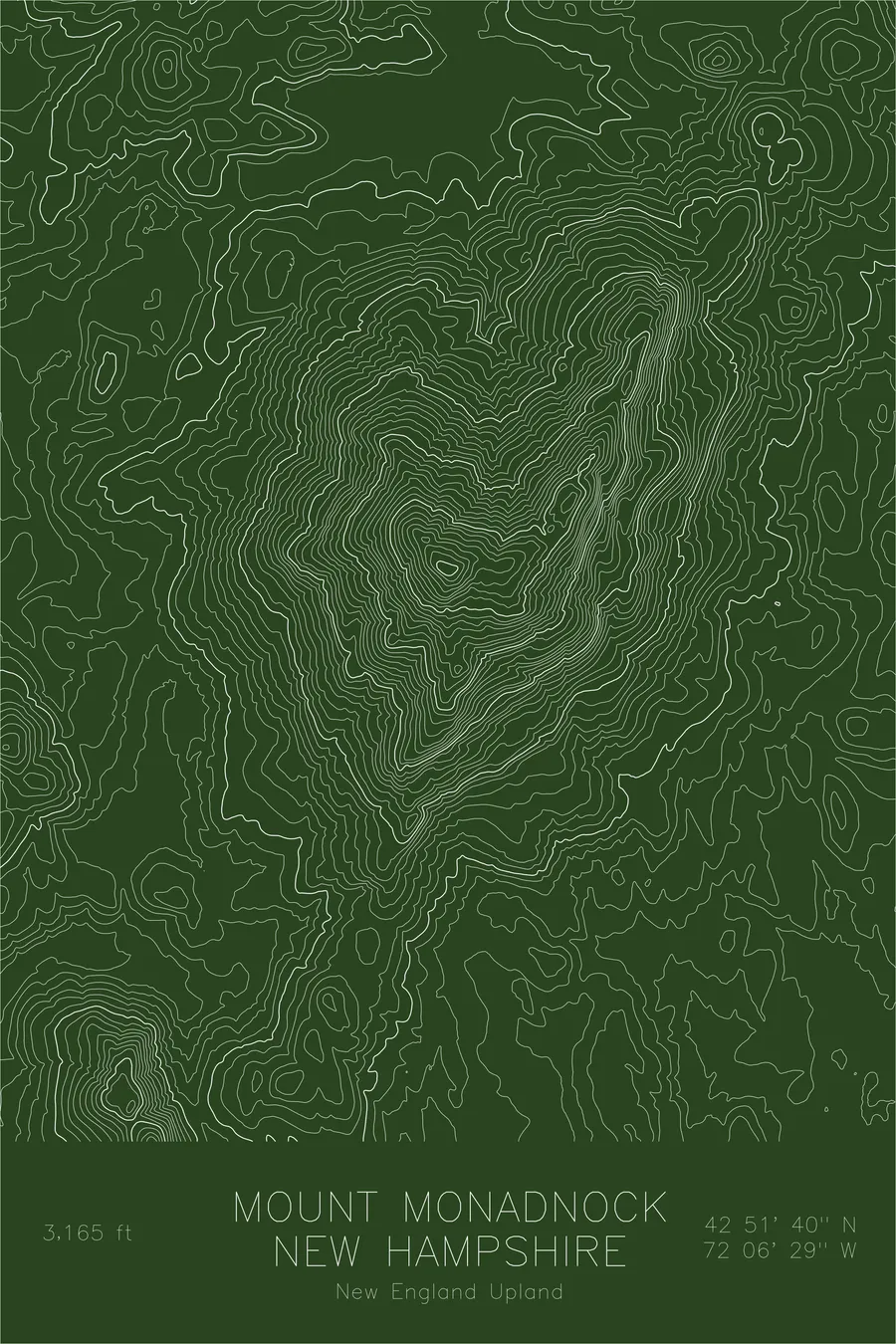
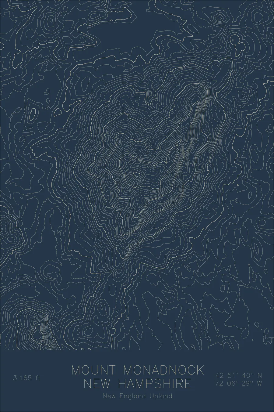
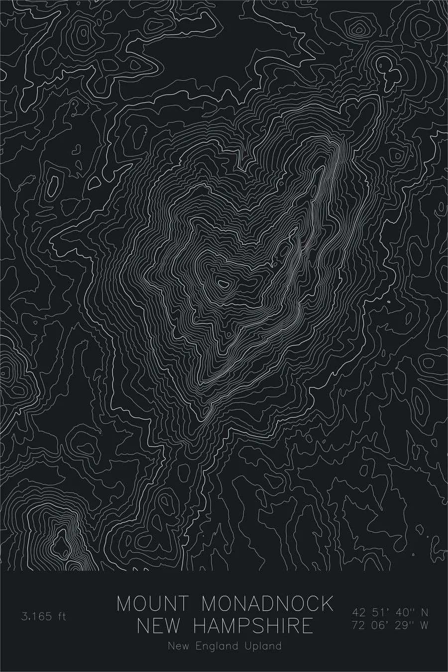
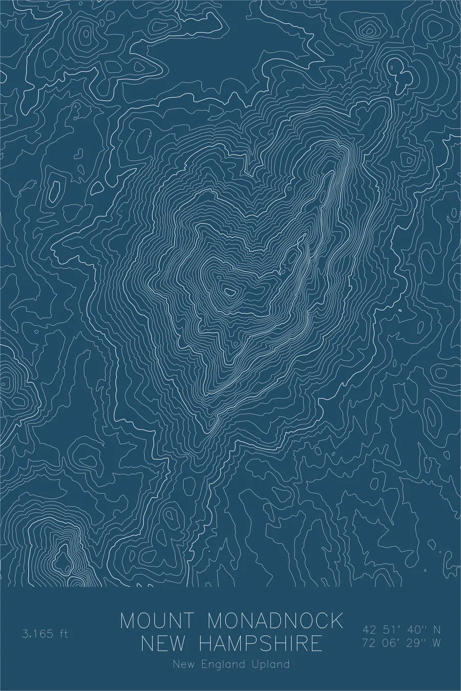
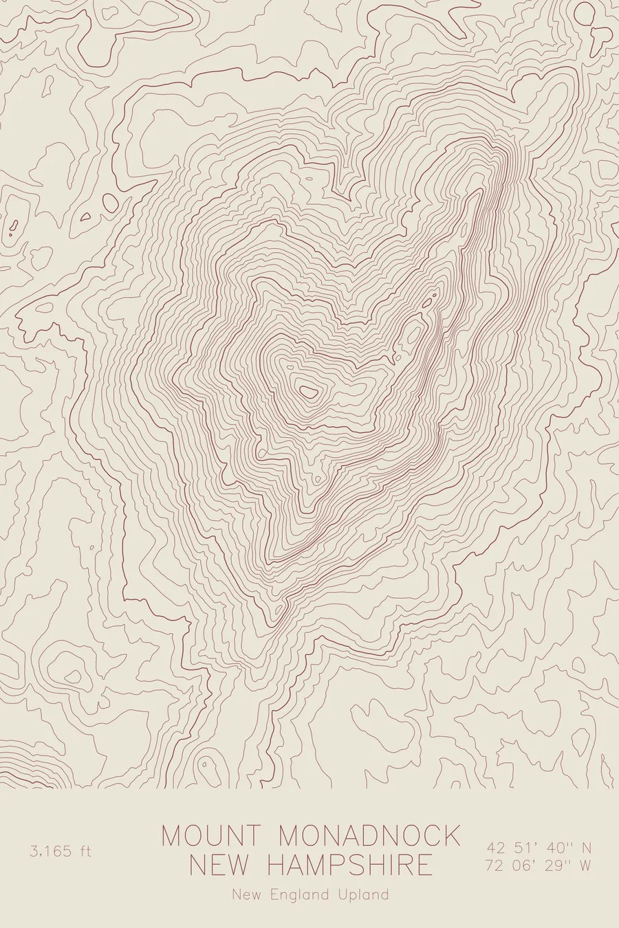
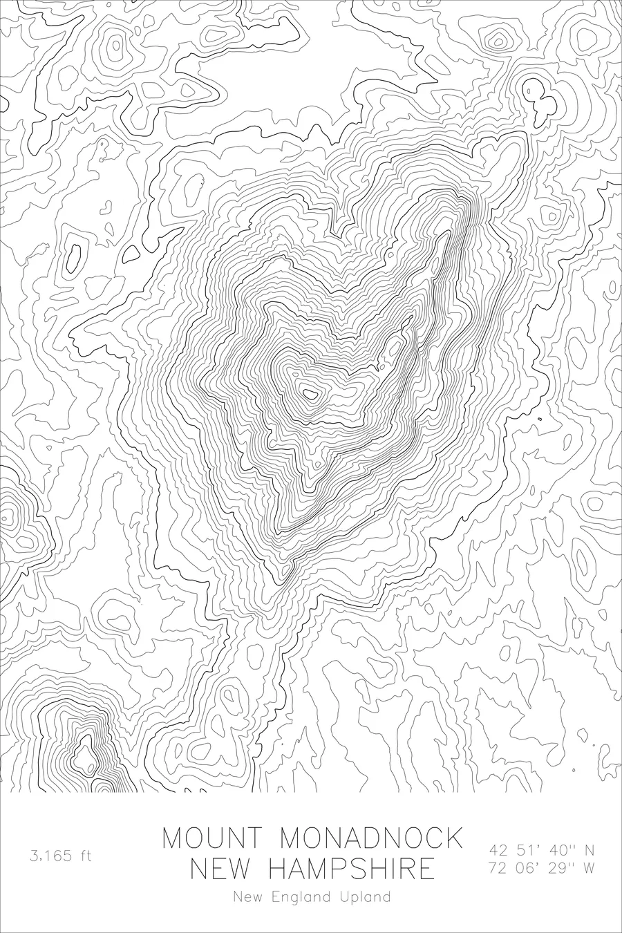
One of the most-climbed mountains in the world. Its name became the geological term for an isolated peak. 3,165 feet above sea level.
$54
Original pen plot · signed · no two identical
Ink & paper: Blue
Size: 12×18"
Made to order. Ships flat in 1–4 business days. Shipping & returns
+ Details
- 12 × 18 inches
- Drawn on 98 lb (160 gsm) archival cotton paper
- Precision technical pens and archival inks
- Signed and dated on the back
- Ships flat, protected, ready to frame
Each map begins with elevation data and is drawn by a pen plotter in our Vermont studio. Mechanical precision, plus the texture and small imperfections of real ink on paper.
+ About this map
Mount Monadnock rises 3,165 feet in southwestern New Hampshire, an isolated summit so distinctive it gave geology a word. A monadnock is any resistant rock mass left standing after the surrounding terrain has eroded away, and this is the original: a knob of metamorphic schist that refused to wear down with the rest of the New England peneplain. It is one of the most frequently climbed mountains in the world, with an estimated 125,000 hikers reaching the summit each year.
This map reveals why the mountain commands such attention despite its modest height. The contour lines show Monadnock rising sharply and alone from the surrounding lowlands, with no connecting ridgeline or neighboring peaks. The upper slopes tighten to bare rock above treeline, the result of fires in the early 1800s that stripped the summit of soil, creating a bald, windswept crown visible from every direction.
+ Site data
- Location
- Mount Monadnock
- Range
- New England Upland
- Region
- Northeast
- Elevation
- 3,165 ft / 965 m
- Coordinates
- 42.8611N 72.1081W
- Type
- peak
- Notes
- One of the most-climbed mountains in the world. Its name became the geological term for an isolated peak
Off the screen
In real rooms


Real plots in the selected colorway
More maps