
Nepal / China
Mount Everest
The highest point on Earth, 29,032 feet of former seafloor.
$54
Original pen plot · signed · no two identical
Ink & paper: Blue
Size: 12×18"
Made to order. Ships flat in 1–4 business days. Shipping & returns
+ Details
- 12 × 18 inches
- Drawn on 98 lb (160 gsm) archival cotton paper
- Precision technical pens and archival inks
- Signed and dated on the back
- Ships flat, protected, ready to frame
Each map begins with elevation data and is drawn by a pen plotter in our Vermont studio. Mechanical precision, plus the texture and small imperfections of real ink on paper.
+ About this map
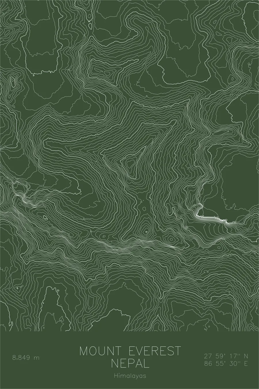
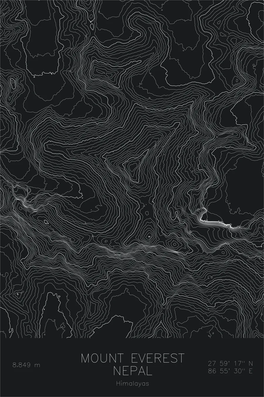
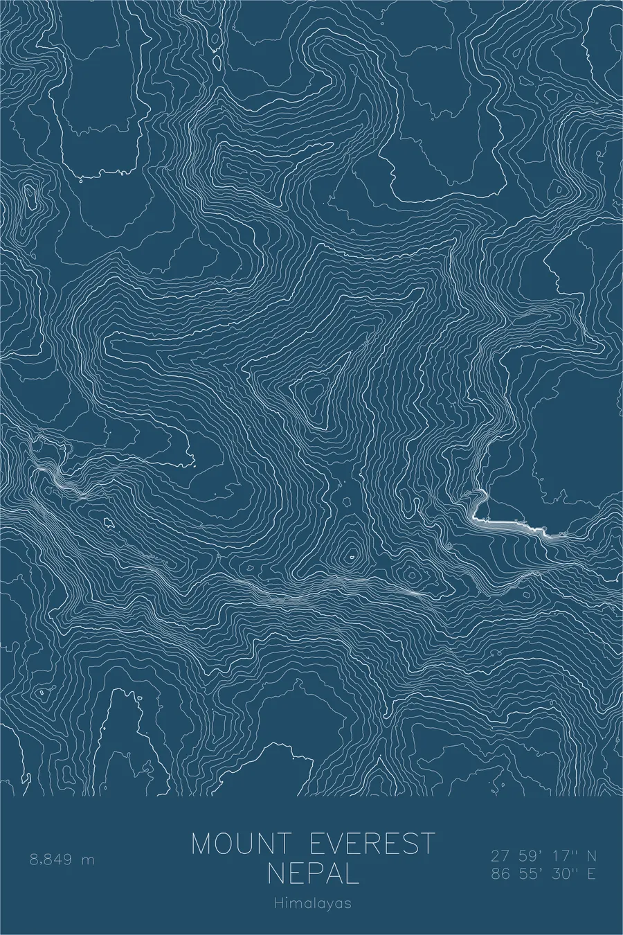
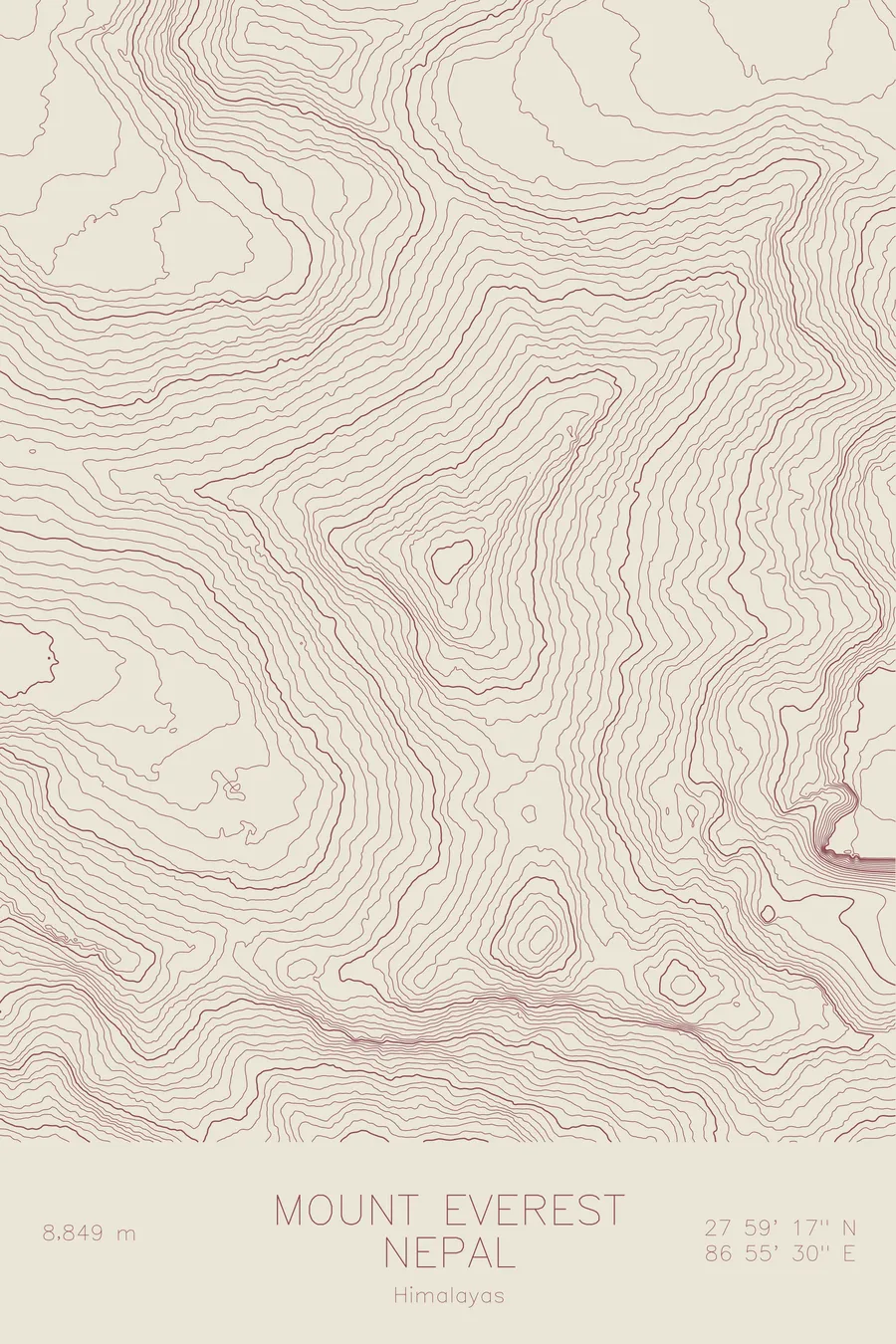
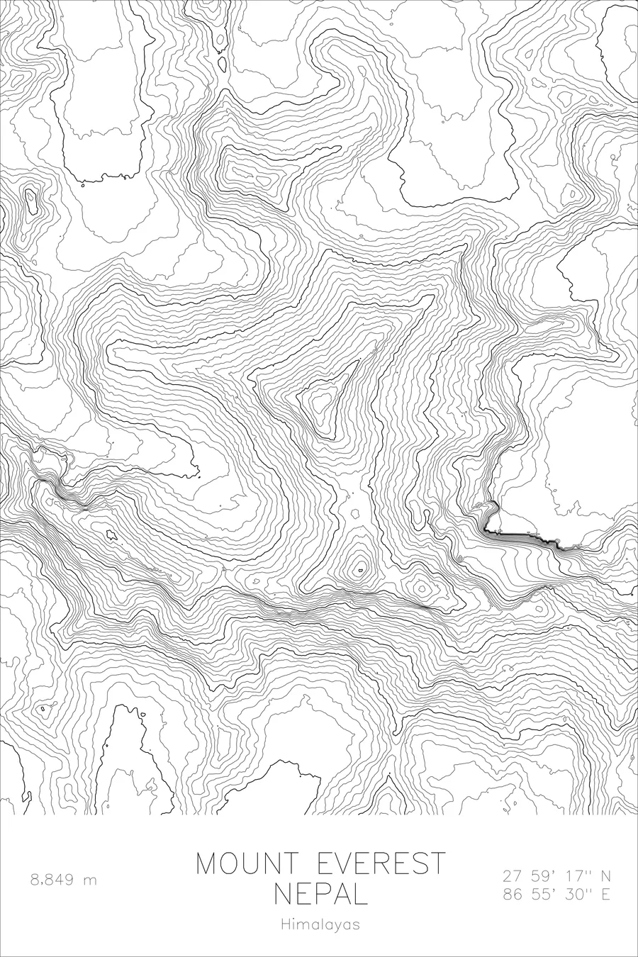
The summit of Mount Everest is marine limestone, which means the highest point on Earth spent its early career as seafloor. The rock at the top still holds the remains of small ocean creatures, carried five and a half miles into the sky by the collision of two continents, a fact geology states plainly and declines to apologize for. The mountain rises 29,032 feet on the border of Nepal and Tibet, Sagarmatha on one side and Chomolungma on the other, and since Tenzing Norgay and Edmund Hillary reached the top in 1953 it has remained the defining objective in high-altitude mountaineering.
This map reveals the massive scale of Everest’s topographic footprint. The contour lines trace the three great ridges that define the mountain’s structure: the Southeast Ridge carrying the standard route from Nepal, the North Ridge rising from the Tibetan plateau, and the West Ridge dropping toward the Lho La above the Khumbu Glacier. Between them, the contours compress into the steep faces that have challenged climbers for over a century. The Khumbu Glacier and its icefall appear as a flattening of contours at the mountain’s base, while the surrounding peaks of Lhotse, Nuptse, and Changtse crowd the map with their own dense contour signatures. Everest sits at the center of the greatest concentration of high terrain on the planet.
+ Site data
- Location
- Mount Everest
- Range
- Himalayas
- Region
- Himalayas
- Elevation
- 29,032 ft / 8,849 m
- Coordinates
- 27.9881N 86.9250E
- Type
- peak
- Notes
- Highest peak on Earth
Off the screen
In real rooms


Real plots in the selected colorway
More maps